
Geocaching Live Karten: Was sie sind und wie du sie nutzt
Eine Geocaching Live Karte ist eine dynamische Online-Kartenanzeige, die Caches in Echtzeit direkt aus der Datenbank einer Geocaching-Plattform auf deinem Gerät darstellt, ohne manuelle Downloads. Was früher ein umständlicher Prozess mit GPX-Dateien war, funktioniert heute per Knopfdruck. Die Karte lädt beim Bewegen automatisch neue Caches nach und verbindet sich dabei mit Plattformen wie Geocaching.com oder Opencaching. Für Geocaching-Einsteiger ist das ein echter Gamechanger, denn der Einstieg gelingt ohne Vorkenntnisse über Dateiexporte. Und auch erfahrene Cacher schätzen die Spontaneität, die Live-Karten ermöglichen.
Wie funktionieren Geocaching Live Karten technisch?
Geocaching Live Karten sind dynamische Darstellungen, die Caches in Echtzeit aus der Geocaching-Datenbank anzeigen, ohne GPX-Downloads. Das bedeutet: Die App fragt beim Verschieben oder Zoomen der Karte automatisch neue Daten ab. Technisch läuft das über eine API-Verbindung zur jeweiligen Plattform, also einem standardisierten Datenaustausch zwischen App und Server.
Der entscheidende Unterschied zum klassischen GPX-Workflow ist die Geschwindigkeit. Beim GPX-Verfahren lädst du Caches manuell herunter, überträgst sie auf dein Gerät und öffnest sie in einer App. Das spart Zeit in der Vorbereitung und unterstützt spontane Touren, weil du keine Vorbereitungszeit brauchst. Du siehst sofort, was in deiner Umgebung versteckt ist.
Besonders praktisch sind die sogenannten Pop-up-Labels. Pop-up-Labels auf Live-Karten zeigen wichtige Cache-Infos sofort, ohne das Listing öffnen zu müssen. Du siehst auf einen Blick: D für Schwierigkeitsgrad, T für Terrain und die Cache-Größe. Das erlaubt schnelle Entscheidungen direkt vor Ort, ohne lange durch Menüs zu scrollen.
Was zeigt die Karte konkret an?
- Cache-Typ: Traditioneller Cache, Mystery, Multi-Cache oder Event-Cache werden durch unterschiedliche Symbole dargestellt.
- Schwierigkeitsgrad (D): Skala von 1 bis 5, direkt auf der Karte sichtbar.
- Terrain (T): Gibt an, wie anspruchsvoll das Gelände ist, ebenfalls auf Skala 1 bis 5.
- Cache-Größe: Von Nano bis Large, erkennbar am Symbol oder Pop-up.
- Status: Ob ein Cache aktiv, deaktiviert oder archiviert ist.
Profi-Tipp: Zoome in der Live-Karte auf einen bestimmten Bereich heran, bevor du losfährst. So lädst du gezielt nur die Caches in deinem geplanten Suchgebiet und sparst Datenvolumen.
Welche Grenzen hat die Nutzung von Live-Karten?
Live-Karten sind praktisch, aber nicht unfehlbar. Die wichtigste Einschränkung: Live-Karten erfordern konstante Datenverbindung, womit Ausfälle bei schwachem Netz zu Ladeproblemen führen können. Wer in Waldgebieten oder abgelegenen Tälern unterwegs ist, kennt das Problem. Die Karte friert ein, neue Caches laden nicht nach, und du stehst ohne aktuelle Daten da.
Dazu kommt die GPS-Genauigkeit. GPS-Genauigkeit liegt häufig bei 10–20 Metern, was im Geocaching-Umfeld berücksichtigt werden muss. Das klingt wenig, bedeutet aber in der Praxis einen Suchradius von bis zu 200 Quadratmetern. Die Karte zeigt dir, wo du ungefähr suchen sollst. Den Cache findest du dann mit Augen und Erfahrung.
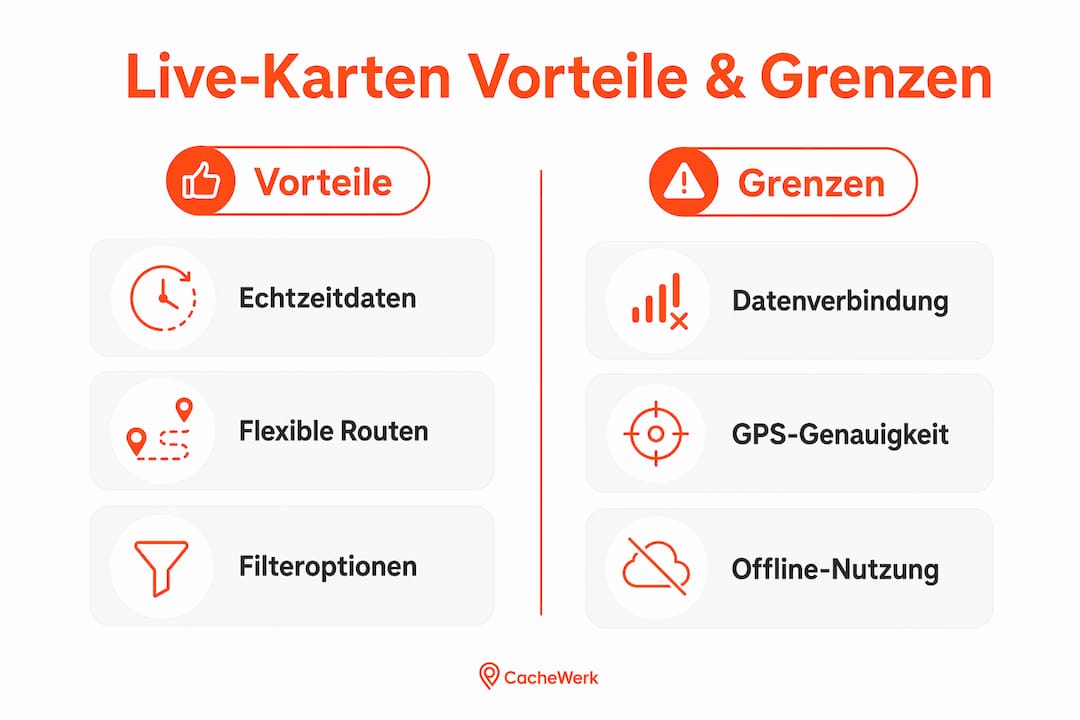
Ein weiterer Faktor ist der Akkuverbrauch. Der Akkuverbrauch steigt durch Dauer-GPS und Datenverbindung erheblich bei Live-Karten-Nutzung. Wer das unterschätzt, steht nach zwei Stunden mit leerem Akku im Wald. Gerade Einsteiger erleben das häufig beim ersten längeren Ausflug.
Die vier größten Herausforderungen im Überblick:
- Netzabdeckung: In abgelegenen Gebieten fehlt oft das Mobilfunksignal für die Live-Synchronisation.
- GPS-Abweichung: Bis zu 20 Meter Ungenauigkeit erfordern aktive Suche vor Ort, nicht blindes Vertrauen auf den blauen Punkt.
- Akkuverbrauch: Dauer-GPS und mobile Daten leeren den Akku deutlich schneller als normaler Betrieb.
- Datenlimit: Wer kein Flatrate-Tarif hat, kann bei intensiver Nutzung schnell sein Datenvolumen aufbrauchen.
Profi-Tipp: Lade dir vor dem Ausflug eine Offline-Cacheliste herunter und nutze die Live-Karte nur ergänzend. Für lange Touren lohnt sich ein mobiles Ladegerät im Rucksack, das deinen Akku unterwegs auffrischt.
Wie unterstützt die Live-Karte die Routenplanung?
Die Live-Karte ist nicht nur ein Suchfenster. Sie ist dein flexibles Planungswerkzeug für ganze Touren. Spontane Routenplanung ist mit Live-Karten einfach möglich, inklusive individueller Strecken und Filterfunktionen. Du siehst auf einen Blick, welche Caches entlang einer Strecke liegen, und kannst deine Route direkt auf der Karte anpassen.
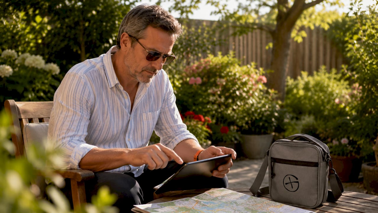
Besonders hilfreich ist die Filterfunktion. Du kannst gezielt nach Cache-Typ, Schwierigkeitsgrad oder Terrain filtern und so eine Tour zusammenstellen, die zu deinem Können und deiner Zeit passt. Wer nur zwei Stunden hat, filtert auf leichte Tradis in der Nähe. Wer einen ganzen Tag plant, sucht nach anspruchsvolleren Touren mit mehreren Wegpunkten.
| Planungsszenario | Empfohlene Filterkombination | Vorteil |
|---|---|---|
| Kurzausflug in der Stadt | Cache-Typ: Tradi, D: 1–2, Größe: Klein bis Mittel | Schnell zu finden, kein Gelände nötig |
| Wandertag mit Familie | Terrain: 1–2, D: 1–3, Cache-Typ: Tradi oder Multi | Geeignet für alle Altersgruppen |
| Sportliche Tagestour | Terrain: 3–5, D: 3–5, Cache-Typ: beliebig | Herausfordernd, für erfahrene Cacher |
| Spontane Stadterkundung | Kein Filter, Live-Karte offen, Umgebung erkunden | Maximale Flexibilität vor Ort |
Ein weiterer Vorteil: Du kannst deine Route spontan ändern. Wenn du unterwegs einen interessanten Cache siehst, den du vorher nicht geplant hattest, klickst du ihn an und nimmst ihn mit. Das macht Geocaching mit Live-Karten deutlich lebendiger als starres Abarbeiten einer vorbereiteten Liste.
Für die Verbindung mit Navigationshilfen lohnt sich ein Blick auf GPS beim Geocaching, wo du detaillierte Empfehlungen für Akku- und Datenmanagement auf langen Touren findest.
Welche Apps bieten Live-Karten-Funktionalität?
Apps wie c:geo bieten Live-Karten sowie Unterstützung für diverse Plattformen, inklusive Offline-Optionen und Filtereinstellungen. c:geo ist dabei die bekannteste Open-Source-Lösung für Android und arbeitet mit Geocaching.com sowie Opencaching zusammen. Die App ist kostenlos und bietet trotzdem einen beeindruckenden Funktionsumfang.
Grundsätzlich lassen sich Geocaching-Apps in zwei Kategorien einteilen:
- Kostenlose Open-Source-Apps: c:geo ist das beste Beispiel. Voller Zugriff auf Live-Karten, konfigurierbare API-Anbindung, Offline-Karten per Download, Filteroptionen direkt in der Kartenansicht. Ideal für Einsteiger und erfahrene Cacher gleichermaßen.
- Kostenpflichtige Premium-Apps: Viele Apps bieten Basisfunktionen kostenlos, Premium schaltet erweiterte Filter oder vollständigen Cache-Zugriff frei. Wer regelmäßig cacht und alle Cache-Typen sehen möchte, kommt um ein Premium-Abo bei Geocaching.com kaum herum.
Apps wie c:geo ermöglichen zudem Filter für Cache-Typen und Bewertungen direkt in der Live-Karte, was die Suchfunktion stark verbessert. Du kannst beispielsweise alle Mystery-Caches ausblenden, wenn du nur Tradis suchst. Oder du filterst nach kürzlich platzierten Caches, um frische Verstecke zu finden.
Die Anbindung an Opencaching ist für viele Cacher ein wichtiges Kriterium. Opencaching ist eine offene, kostenfreie Plattform ohne Pflicht-Abo. Wer ausschließlich dort cacht, findet in c:geo eine vollwertige Lösung ohne zusätzliche Kosten. Wer beide Plattformen kombinieren möchte, kann das in einer einzigen App erledigen.
Wichtige Erkenntnisse
Geocaching Live Karten erfordern eine aktive Internetverbindung, liefern dafür aber Echtzeit-Cachedaten, flexible Routenplanung und schnelle Entscheidungshilfen direkt vor Ort.
| Thema | Details |
|---|---|
| Grundfunktion | Live-Karten zeigen Caches in Echtzeit per API, ohne GPX-Download. |
| Pop-up-Labels | Schwierigkeitsgrad, Terrain und Größe sind sofort auf der Karte sichtbar. |
| GPS-Genauigkeit | Abweichungen von 10–20 Metern erfordern aktive Suche, nicht blindes Folgen. |
| Akkumanagement | Dauer-GPS und Daten verbrauchen viel Energie; Powerbank auf langen Touren empfohlen. |
| Offline-Strategie | Cachelisten vor dem Ausflug speichern, Live-Karte nur ergänzend nutzen. |
Meine Erfahrung mit Live-Karten: Was wirklich zählt
Ich erinnere mich noch gut an meinen ersten Ausflug mit einer Live-Karte. Ich war begeistert, wie viele Caches plötzlich auf dem Bildschirm auftauchten. Und dann war der Akku nach 90 Minuten leer. Klassischer Anfängerfehler.
Was ich seitdem gelernt habe: Live-Karten sind ein Werkzeug zur Übersicht, kein Ersatz für Vorbereitung. Technikexperten raten, Live-Karten hauptsächlich zur Übersicht und Planung zu nutzen und vor Ort auf analoge Suche zu wechseln. Das schützt vor falschem Vertrauen auf GPS und erhöht die Erfolgschancen. Ich halte das für den wichtigsten Rat überhaupt.
Für Einsteiger senken Live-Karten die Einstiegshürde enorm. Kein Herumhantieren mit GPX-Dateien, kein Vorwissen über Dateiexporte. Einfach App öffnen, Karte laden, losgehen. Das ist gut. Aber wer glaubt, der blaue GPS-Punkt führt ihn direkt zum Cache, wird frustriert. Die letzten 20 Meter findest du mit Augen und Erfahrung, nicht mit der Karte.
Mein persönlicher Workflow: Ich plane die Tour zuhause grob mit der Live-Karte, speichere die interessantesten Caches offline und nutze die Live-Ansicht unterwegs nur, wenn ich spontan etwas Neues entdecken möchte. Das spart Akku und Nerven.
— Benedikt
Passendes Zubehör für deine nächste Geocaching-Tour
Wer mit Live-Karten unterwegs ist, braucht mehr als nur eine gute App. Die richtige Ausrüstung macht den Unterschied zwischen einer entspannten Tour und einem frustrierenden Ausflug.

Bei Cachewerk findest du alles, was du für aktive Touren brauchst. Die Geocacher Crossbody Bag mit Opencaching-Logo hält dein Smartphone griffbereit und lässt dich gleichzeitig beide Hände frei. Für das Verstecken eigener Caches ist die Ammo-Box Trick Edition eine robuste und kreative Wahl. Und wer Mikrocaches pflegt, findet mit den wasserdichten Micro Logstreifen das passende Logbuch für kleine Verstecke. Qualität, die draußen hält, was sie verspricht.
FAQ
Was sind Geocaching Live Karten genau?
Geocaching Live Karten sind digitale Kartenansichten, die Caches in Echtzeit aus einer Geocaching-Datenbank laden und anzeigen, ohne manuelle GPX-Downloads. Sie verbinden sich per API mit Plattformen wie Geocaching.com oder Opencaching.
Brauche ich für Live-Karten immer eine Internetverbindung?
Ja. Live-Karten benötigen eine aktive Datenverbindung, um Caches in Echtzeit zu laden. In Gebieten ohne Mobilfunknetz empfiehlt sich eine vorab gespeicherte Offline-Cacheliste als Backup.
Wie genau ist die GPS-Anzeige auf der Live-Karte?
GPS-Geräte und Smartphones weichen häufig um 10–20 Meter vom tatsächlichen Standort ab. Das bedeutet in der Praxis: Die Karte zeigt dir den ungefähren Bereich, den Cache selbst findest du durch aktives Suchen vor Ort.
Welche App eignet sich am besten für Live-Karten?
c:geo ist die bekannteste kostenlose Open-Source-App für Android mit vollwertiger Live-Karten-Funktion, Offline-Unterstützung und Anbindung an Geocaching.com sowie Opencaching. Für iOS gibt es vergleichbare kostenpflichtige Alternativen mit ähnlichem Funktionsumfang.
Wie schone ich den Akku beim Geocachen mit Live-Karten?
Dauer-GPS und mobile Daten verbrauchen viel Energie. Lade Cachelisten vorab herunter, reduziere die Bildschirmhelligkeit und nimm eine externe Powerbank mit. So hält der Akku auch auf mehrstündigen Touren durch.