
GPS for Geocaching: Mastering Better Searches and Hides
Many geocachers blindly trust their GPS. But what if the device takes you up to 40 meters away from the actual target? Dedicated GPS devices offer better accuracy than smartphones, but even the best hardware has its limits. Innovations like Multi-GNSS, WAAS, and RTK are fundamentally changing the treasure hunt. In this article, you will learn how GPS really works, where typical errors occur, and which technology offers the greatest benefit for you as a geocacher. We also provide practical tips on how to hide your caches more precisely and find them more reliably.
Table of Contents
- GPS Basics and Typical Sources of Error in Geocaching
- Comparison: Smartphones vs. Dedicated GPS Devices in Everyday Geocaching
- Modern GPS Technologies: Multi-GNSS, WAAS & RTK in Geocaching
- Tips for Optimal GPS Usage and Creative Hides
- Why an Upgrade is Worthwhile – But Less High-Tech Often Brings More Fun
- GPS Technology and Equipment for Your Next Geocaching Adventure
- Frequently Asked Questions
Key Takeaways
| Point | Details |
|---|---|
| Understand sources of error | Multipath, obstructions, and atmosphere significantly affect GPS signal and accuracy in the field. |
| Compare device types | For frequent geocachers, a dedicated GPS device offers more reliability and functionality than smartphones. |
| Use high-tech strategically | RTK and Multi-GNSS make exact hides and creative multi-caches possible. |
| Practice beats theory | The most tangible results come from combining technology, experience, and community tips. |
GPS Basics and Typical Sources of Error in Geocaching
Before innovations can help, it's worth looking at the basics and what often goes wrong in practice.
GPS works by using signals from at least four satellites simultaneously. Your device measures the travel time of these signals and calculates your position. This process is called a "fix." The more satellites that are visible, the more accurate the fix will be. Sounds simple, but it isn't always.
The biggest problem in the field is the so-called multipath effect. Satellite signals bounce off buildings, rocks, or trees before reaching your device, distorting the travel time measurement. Something similar happens under a dense canopy, which is called canopy blockage: trees absorb or delay signals. The ionosphere, a layer in the Earth's atmosphere, also slows down signals and causes deviations.
Another phenomenon is overshoot. Your device briefly displays a position after being turned on that is not yet stable. If you start walking immediately, you'll be looking in the wrong place.
How large are these deviations in practice? Here's an overview:
| Environment | Typical Deviation |
|---|---|
| Open field, good visibility | 3 to 5 meters |
| Urban area, buildings | 10 to 20 meters |
| Dense forest | up to 40 meters |
| Gorge or valley | up to 50 meters |
Under ideal conditions, GPS accuracy is 3 to 10 meters, but in forests or difficult environments, it can be up to 40 meters. This means that even an expensive device can lead you completely astray in the wrong forest.
What does this mean for treasure hunting specifically?
- In the forest: Always plan for a search radius of at least 10 meters
- In the city: Pay attention to multipath, keep the device away from buildings
- In bad weather: Ionospheric disturbances increase
- After switching on: Wait at least 2 minutes until the fix is stable
The standard deviation, i.e., the average deviation over many measurements, is often less than 5 meters for modern devices. But a single bad moment is enough to miss a cache.
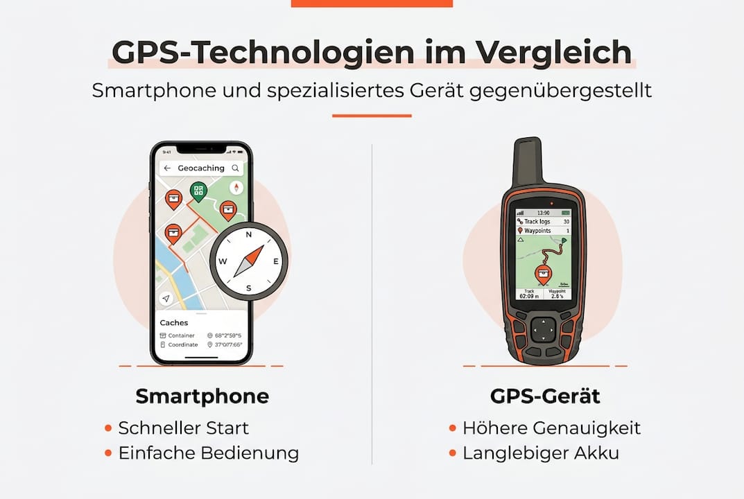
Comparison: Smartphones vs. Dedicated GPS Devices in Everyday Geocaching
Once you know the weaknesses, you might wonder: Which technology provides the most benefit? Let's find out in a direct comparison.
Smartphones are sufficient for beginners, but dedicated GPS devices like Garmin are more robust, more accurate, and have longer battery life. This is not an advertising slogan, but practical experience.
| Feature | Smartphone | Dedicated GPS Device |
|---|---|---|
| Accuracy | 5 to 15 meters | 3 to 8 meters |
| Battery life | 4 to 8 hours | 15 to 25 hours |
| Robustness | Medium | High (waterproof) |
| Price | Already owned | 150 to 600 Euros |
| Offline maps | App required | Integrated |
| Operation | Intuitive | Learning curve needed |
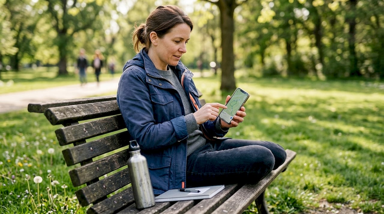
For a beginner, the smartphone is the perfect entry point. The geocaching.com or c:geo app runs immediately, and the operation is familiar. However, anyone who regularly goes into the forest or in the rain quickly reaches their limits.
An advanced geocacher with 50 or more caches found per year will immediately notice the difference. Dedicated devices withstand falls, work in wet conditions, and provide reliable positions even without a mobile network.
Especially with multi-caches or challenging puzzle caches, precision makes all the difference. When coordinates need to be accurate to within 2 meters, every detail counts.
Pro Tip: If you want to switch from a smartphone to a GPS device, you should first use both in parallel. This way, you learn the differences in practice without having to immediately adapt.
Additional advantages of dedicated devices:
- Paperless geocaching with direct logbook
- Compass with tilt sensor for difficult terrain
- Larger displays with better contrast in sunlight
- Direct coordinate input without an app
Modern GPS Technologies: Multi-GNSS, WAAS & RTK in Geocaching
With these fundamentals in mind, some people venture deeper into the world of technology. Which innovations are truly game-changers today?
Multi-GNSS means that your device not only uses American GPS satellites but also Russian GLONASS, European Galileo, and Chinese BeiDou satellites. This sounds technical, but it has a simple effect: More satellites mean more stable and accurate fixes, especially in difficult terrain.
Multi-GNSS combinations significantly increase positioning reliability, and RTK even enables centimeter-level accuracy. This changes what is possible in geocaching.
Here's an overview of the most important modern technologies:
- Multi-GNSS: Combination of multiple satellite systems for more stable fixes
- WAAS/SBAS: Correction signals from ground stations improve accuracy to 1 to 3 meters
- RTK-GNSS: Real-time corrections enable centimeter accuracy for precise hides
- Assisted GPS (A-GPS): Faster fix through preliminary data from the internet
RTK-GNSS is originally a tool for surveyors and civil engineers. Geocachers are now discovering it for particularly demanding hides where a meter of deviation makes the cache harder to find.
Pro Tip: WAAS is already integrated into modern Garmin devices. Activate it in the settings if it doesn't run automatically. This often gives you 2 to 4 meters of accuracy without extra cost.
When is high-end technology really worthwhile?
- For challenging multi-caches with many waypoints
- When hiding your own caches, where coordinates must be exact
- For puzzle caches with precise offset coordinates
- For cache owners who want to offer their seekers a fair experience
For a normal traditional cache, a smartphone is perfectly sufficient. But those who place their own caches or solve complex multi-caches will noticeably benefit from better technology.
Tips for Optimal GPS Usage and Creative Hides
Theory is good, but practice is everything. Here, we show you how your GPS becomes a successful tool for searching and hiding.
Calibration, waypoint averaging, and external antennas significantly increase accuracy. Sometimes, deliberately offset coordinates are even desired for creative caches.
Here's how to optimize your GPS accuracy step by step:
- Calibrate your device: Recalibrate the compass and barometer regularly, especially after temperature changes
- Wait for warm-up: After turning it on, wait 2 to 3 minutes until the fix is stable
- Use Waypoint Averaging: Average multiple measurements to eliminate outliers
- Seek clear view: Before the final measurement, find open areas, avoid trees
- Consider an external antenna: For professional applications, an external antenna significantly improves signal quality
For creative and secure hides, the offset technique is particularly interesting. Here, you don't provide the exact coordinates of the hide, but a starting point. From there, clues or calculations lead to the actual location. This makes caches more exciting and cleverly compensates for GPS deviations.
Further practical recommendations:
- Measure multiple times: Record coordinates on different days and times
- Compare devices: Measure at the same point with two different devices and use the average
- Include hints: For dense forests, add additional visual hints in the cache description
- Specify search radius: Honestly communicate in the description if the environment causes GPS deviations
Pro Tip: When hiding your own caches, always simulate the search radius from a smartphone's perspective. Many finders do not use a dedicated device. What seems precise to you with RTK can be 10 meters off for others.
With these methods, you can place caches that are fair yet challenging. That is the goal of every good cache owner.
Why an Upgrade is Worthwhile – But Less High-Tech Often Brings More Fun
Here's our honest assessment: Not every innovation makes geocaching better.
An RTK-GNSS system costs several hundred euros and requires technical knowledge. For most hobby geocachers, this is simply overkill. A well-calibrated mid-range Garmin device is perfectly sufficient for 95 percent of all caches.
What really matters is the interplay of technology, experience, and creativity. The best caches we know weren't hidden with high-tech. They were hidden with cleverness. An inconspicuous stone, a perfectly disguised container, a puzzle that makes you think. No GPS in the world can replace that.
Our recommendation: Invest in a solid GPS device if you cache regularly. But also invest in your creativity when hiding. Over-engineering, i.e., overly complicated coordinate systems or overly precise hides, frustrates finders more than it excites them. The community appreciates fair, well-thought-out caches. Technology is a means to an end, not an end in itself.
GPS Technology and Equipment for Your Next Geocaching Adventure
If you want to upgrade your equipment, you'll find suitable recommendations now.
At cachewerk.de, you'll find everything you need for a successful treasure hunt. From weather-resistant hides to camouflage materials and special accessories for urban and rural caches. Our products are designed for the needs of real geocachers, not for the mass market.
Whether you're just starting out or have already found hundreds of caches: the right geocaching equipment makes all the difference. Check out our range and discover products that will take your treasure hunt to the next level. High-quality, durable, and thoughtfully designed for any environment.
Frequently Asked Questions
What GPS accuracy is sufficient for geocaching?
For most caches, an accuracy of 10 to 15 meters is perfectly adequate. For demanding multi-caches or precise hides, higher accuracy is useful, with RTK allowing centimeter accuracy.
How can I improve the positional accuracy of my GPS?
Calibrate your device regularly, use waypoint averaging, and, if possible, opt for devices with Multi-GNSS. External antennas and calibration also help in difficult conditions.
Are dedicated GPS devices better than smartphones?
Yes, for avid geocachers, definitely. Dedicated GPS devices are more accurate and have significantly longer battery life than smartphones, especially on long trips.
When is RTK-GNSS worthwhile for geocaching?
RTK-GNSS is particularly worthwhile for cache owners who want to create extremely precise hides. The technology allows for accuracies of 6 mm to 1 cm and is therefore oversized for standard searches.